JUNE 27, 2019 – Camp Sherman, OR
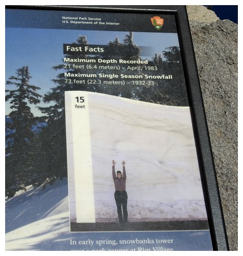
We are now back in the RV after more than a month of it being at Camping World for a few warranty repairs and new parts. Most of the work is done but we are still waiting for parts to the awning and the new leveling system which is expected July 5. We’ll take it back for that work and hope it is completed quickly. This is our third trip away from Portland!! This trip is to go (finally) to Crater Lake National Park. The east side of the rim road is supposed to be open this Friday, June 28.
After a couple of days of planning and consulting with cousin Patrick, we had our itinerary and lodging stops determined. Rather than drive the truck around the rim road we found a trolley company that runs a 2-hour tour with a NPS guide that runs every hour from the lodge and has pickup at the Mazama Campground just south of the crater.
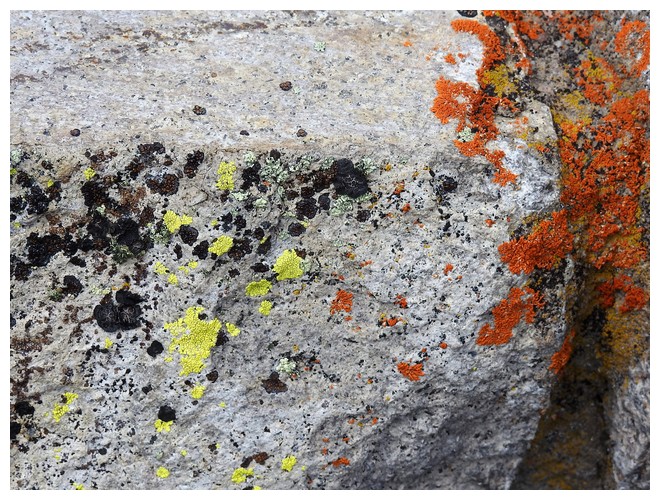
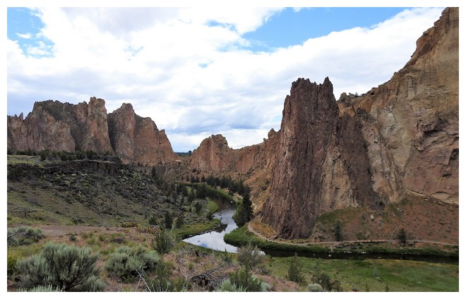
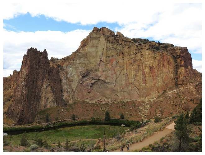
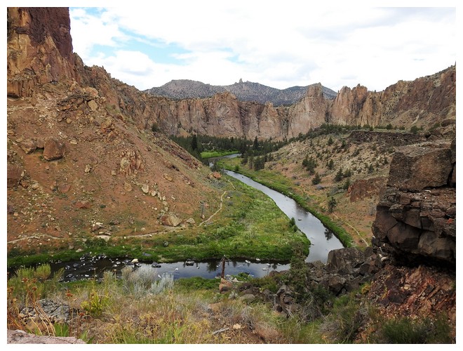
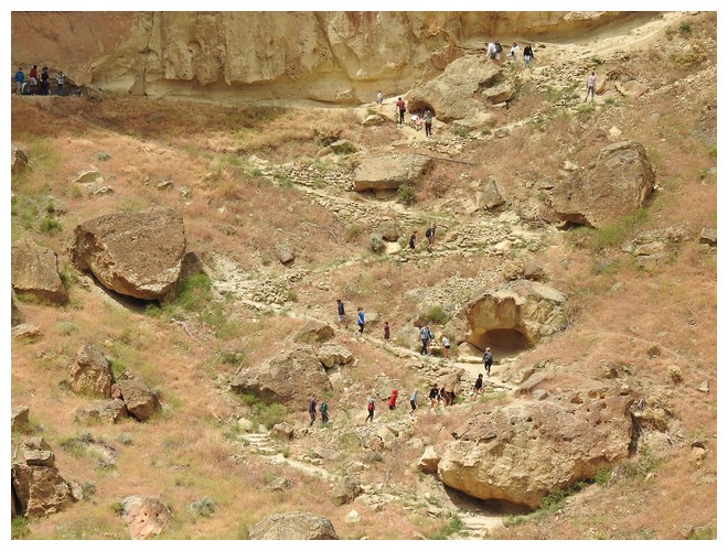
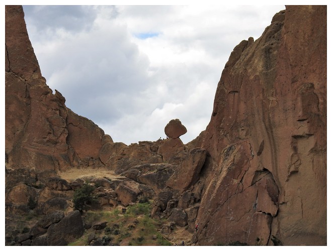
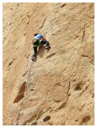
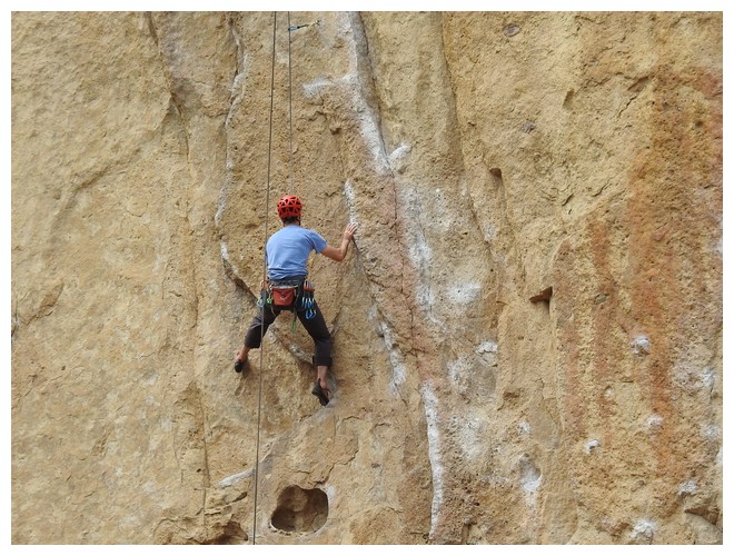
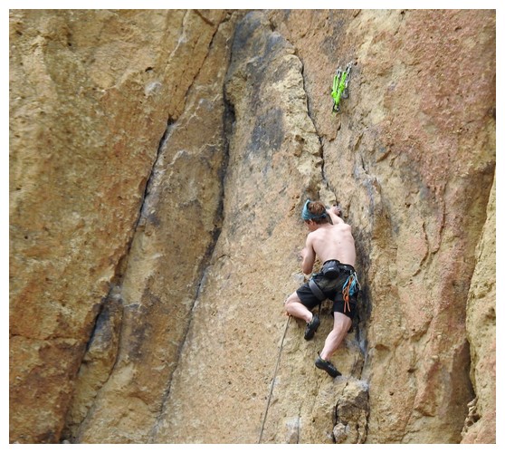
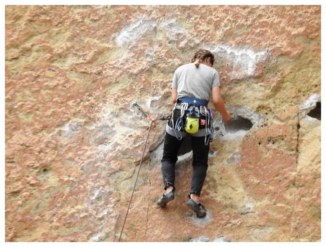
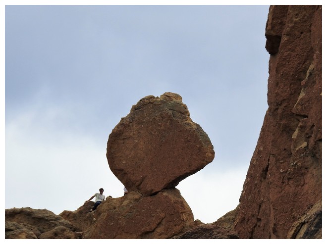
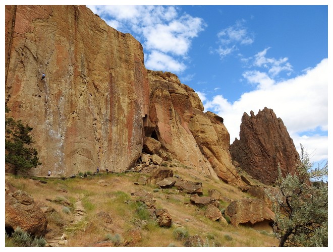
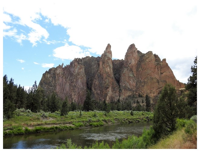
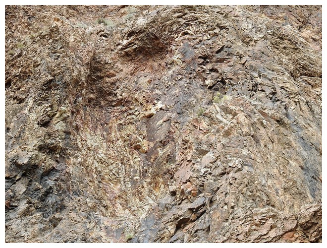
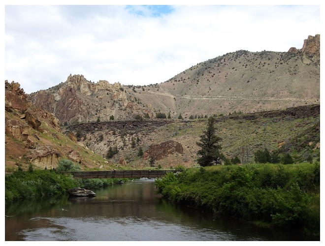
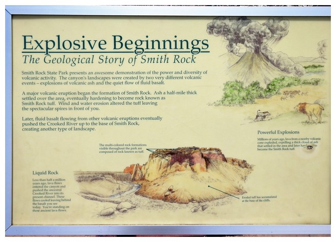
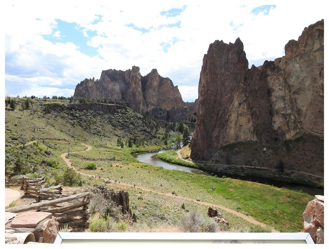
We departed in the morning with the first stop, after 3+ hours, at Smith Rock. It indeed is AMAZING. Its origins are a combo of volcanic actions that created this massive multi colored, vertically faced outcropping. We walked down to Crooked Creek and walked for a while. We came to a spot where there were lots of rock climbers clinging to the face. There were also lots of telltale sign of prior activity with the numerous residual hand hold chalk markings. It’s not clear that there are bolts all the way to the top. I understand now why this is such a terrific spot for rock climbers.
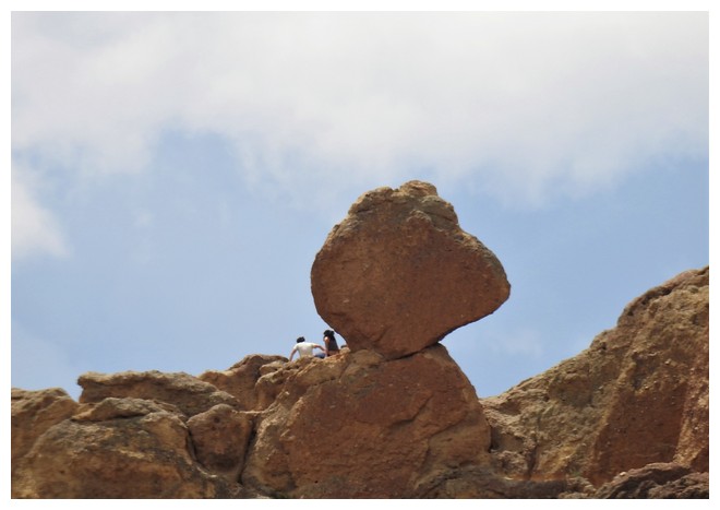
We also had terrific views of the iconic Monkey Face rock that stands up at the end of the canyon. On a close-up you can almost see eyelashes!! It’s a beautiful location with amazing scenery.
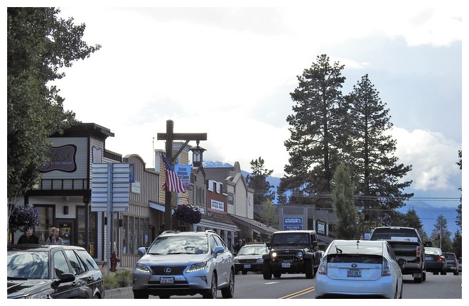
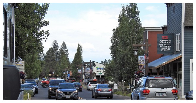
We moved along and through the town of Sisters OR. A quaint small town with basically 1 or 2 main streets with shops restaurants, etc. It reminded me of a miniature Edgartown, Martha’s Vineyard, but on steroids……
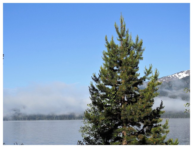
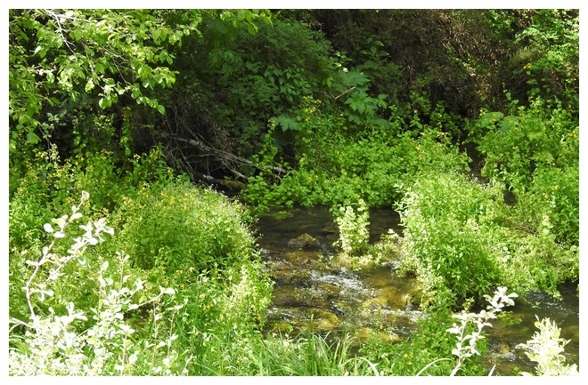
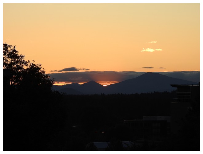
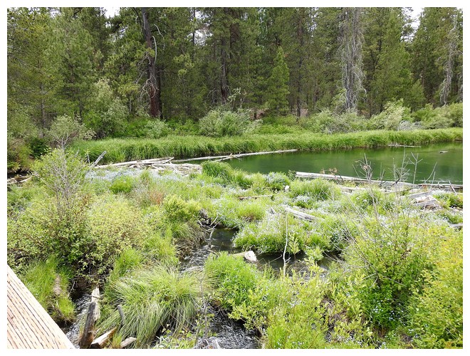
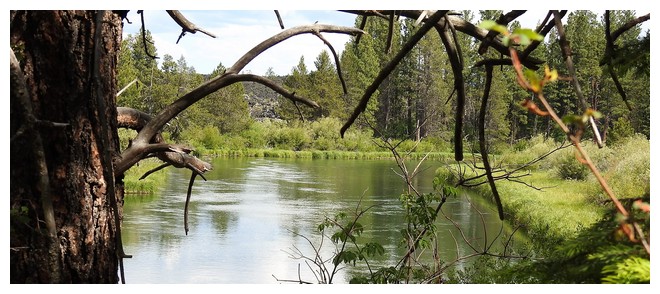
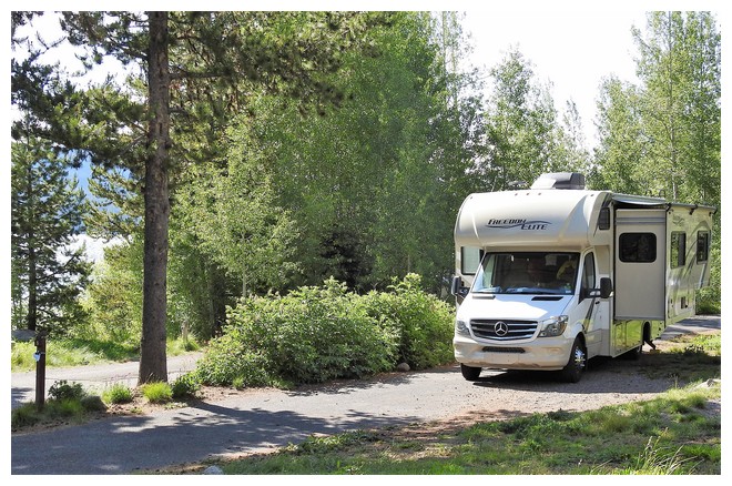
Our spot for the night is near the Metolius River in a small area known as Camp Sherman. We managed to book a spot at an rv campground as the Forest Service sites had only walk-in availability or in other words reservations could not be made. As we were arriving later in the day I was nervous that we’d arrive and have no place to stay.
JUNE 28, 2019 – Bend, OR
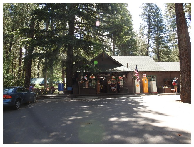
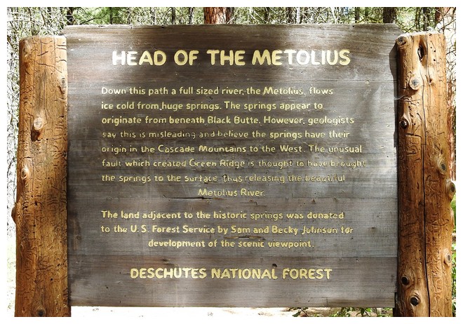
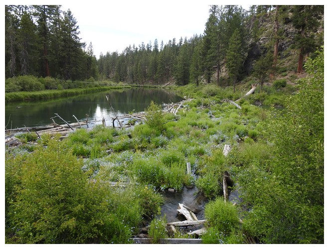
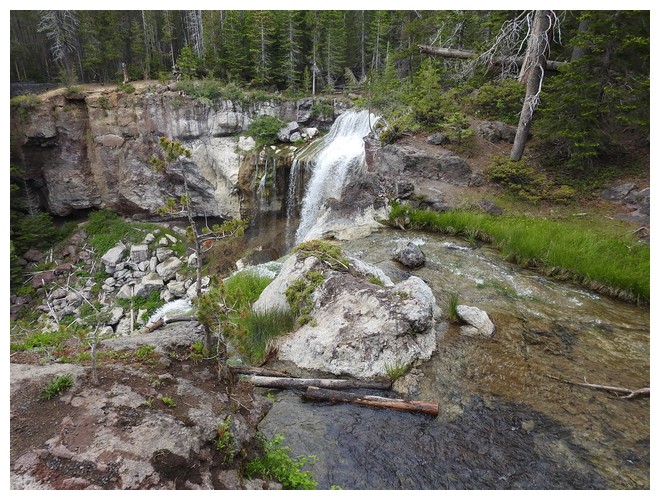
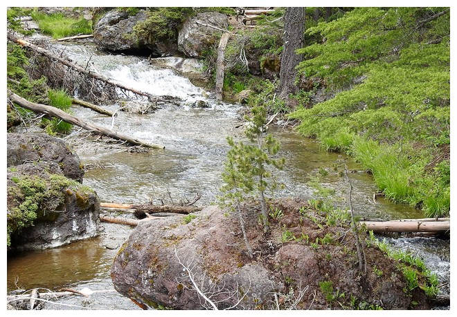
We packed up and unmoored the RV and headed for the headwaters of the Metolius River. We stopped at the “famous” Camp Sherman store. It is quite the place. They have everything from a deli counter to tshirts to sunglasses, camping gear, wine, and lots of fishing gear and supplies.
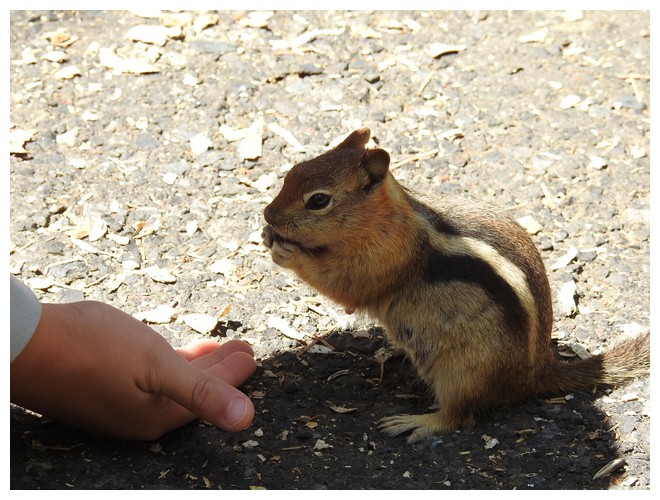
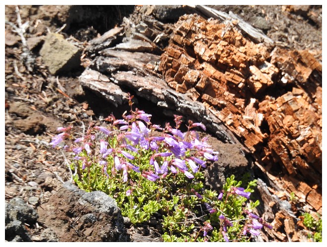
We got our directions and left with a breakfast burrito! The day was clear and sunny and about 10 minutes later we were at the parking lot for the springs. The walk was perfect and the chipmunks were so tame they came right up and basically said “please, may I have a treat!” Farther down the path were grandparents and a little boy, who, of course, was feeding them. There were half a dozen or more all competing for the treats, rushing away and then returning…. Fun to watch.
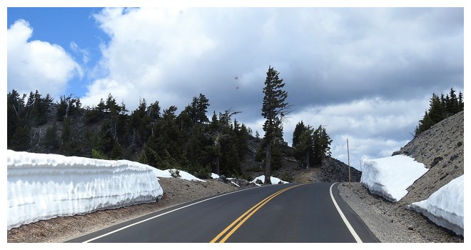
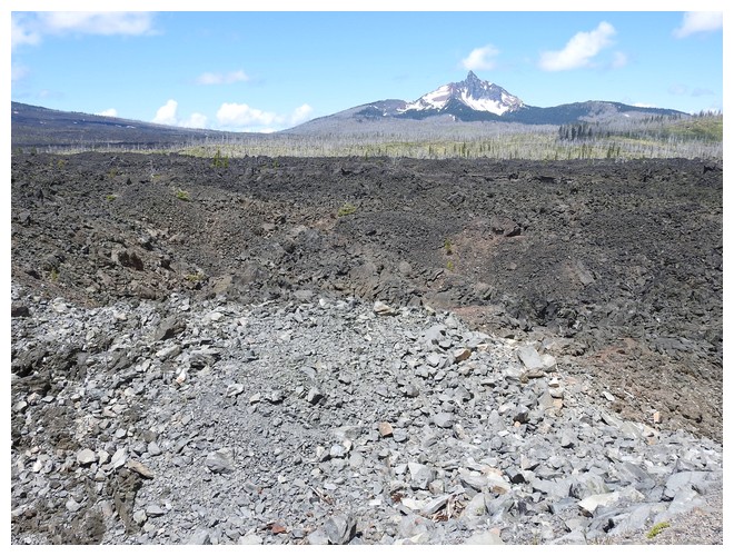
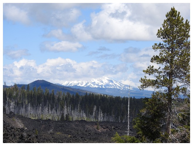
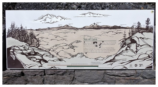
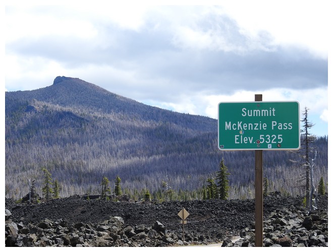
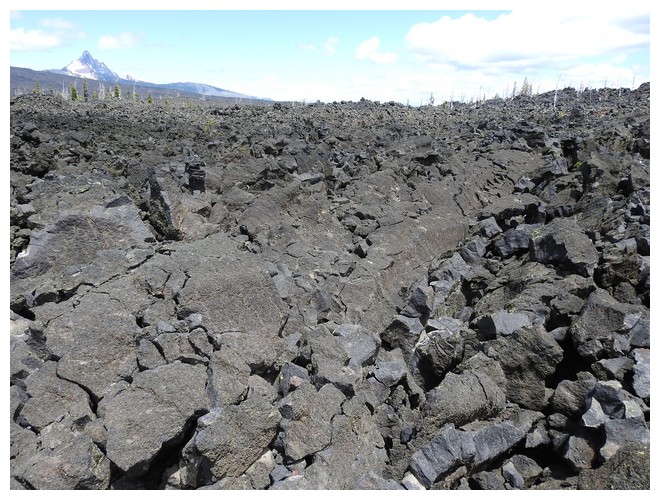
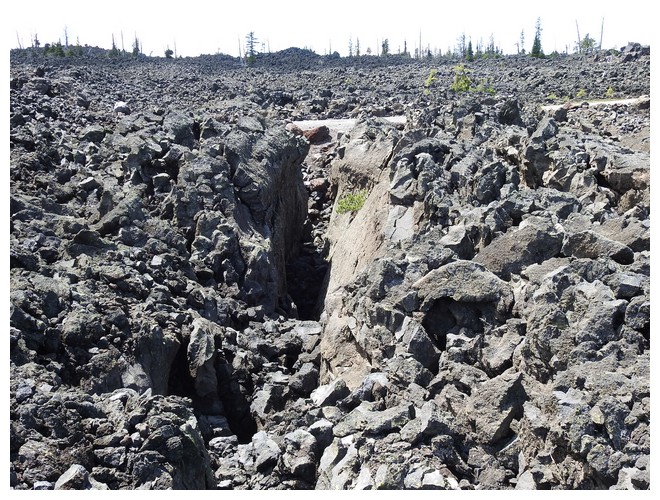
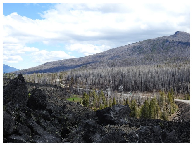
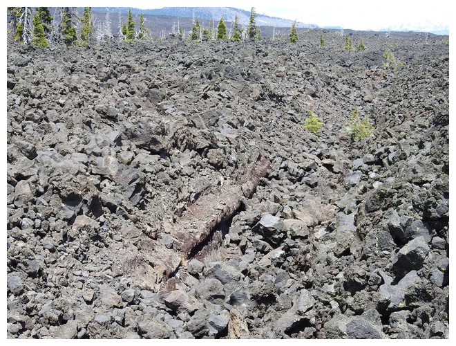
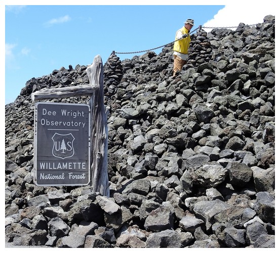
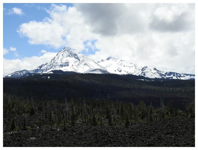
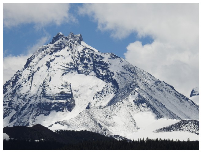
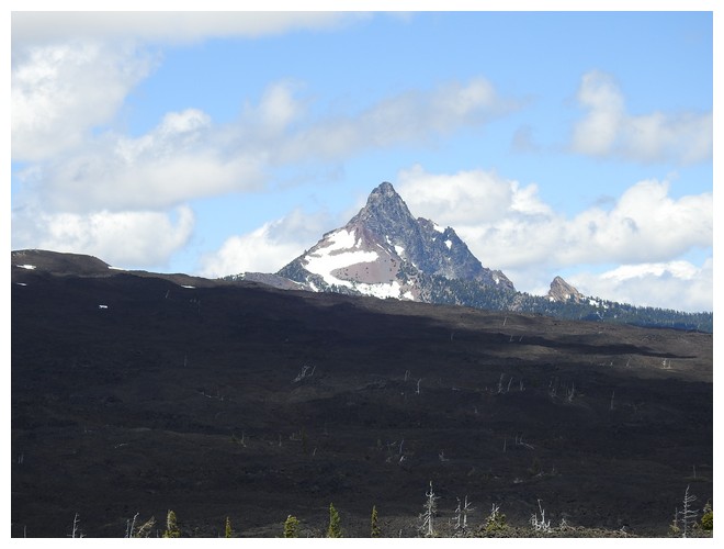
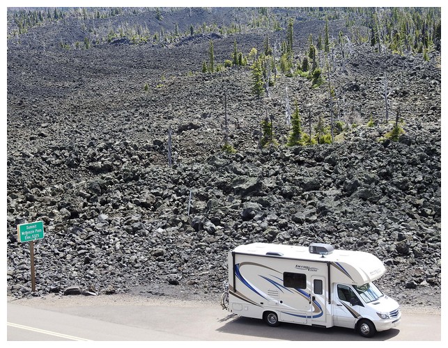
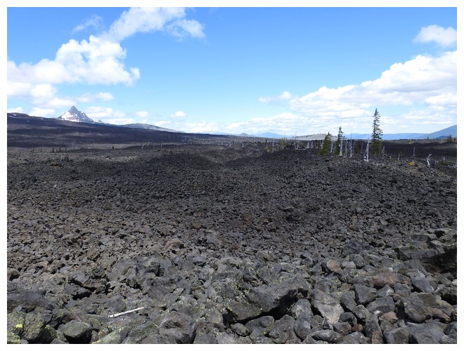
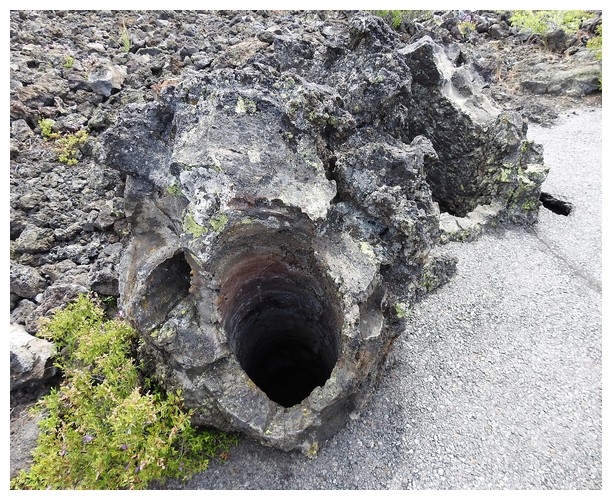
Next stop was a turn west to the Dee Wright Observatory. Not knowing it didn’t have to do with star gazing, it was fun to drive up the winding road to elevation 5325’ where there was a stone tower to “observe” the immense lava field. What a strange place. The signs along the short walk out and back were very informative. It was a very narrow and twisty road that runs east west between Sisters and Eugene, OR, with speeds occasionally down to 15mph and prohibitions to vehicles more than 35’ long. So glad we came out here.
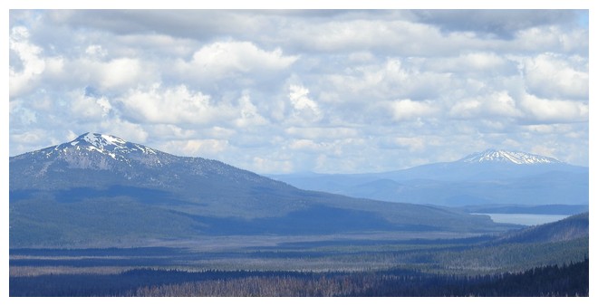
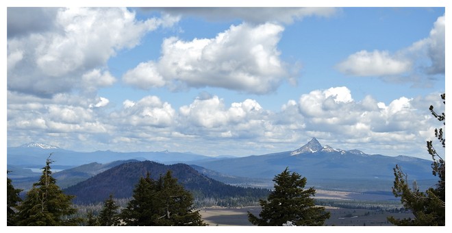
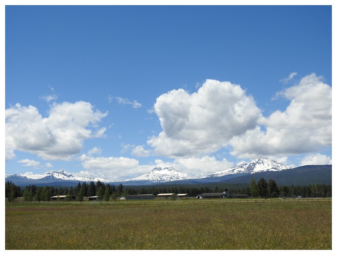
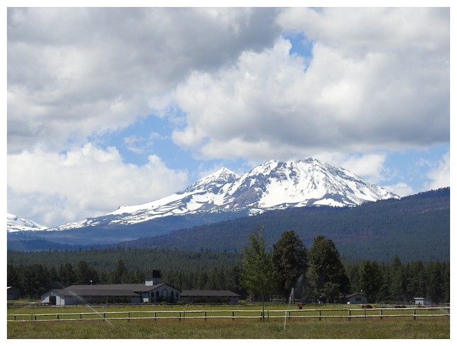
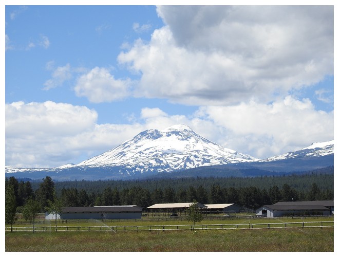
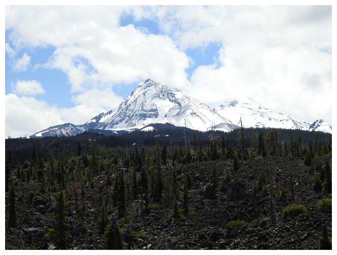
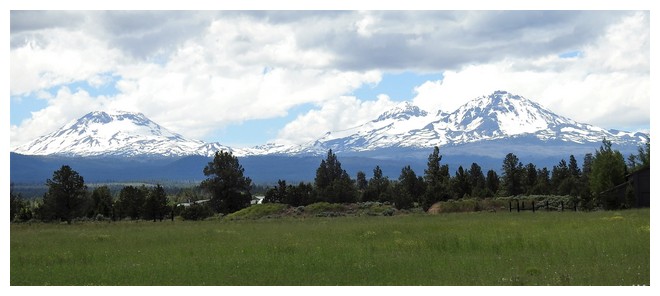
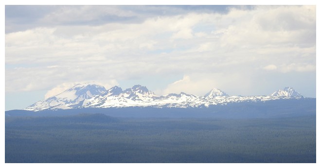
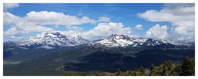
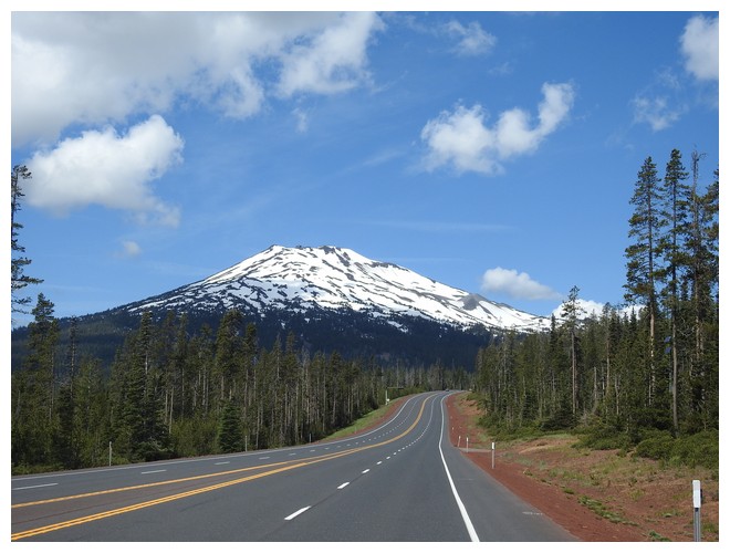
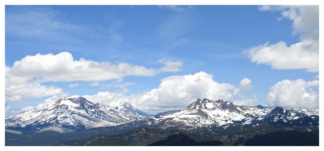
Throughout the day, with the sun and blue sky, and some clouds, I kept taking pictures of the mountains known as Three Sisters. From the observatory there was a very clear visage that once spotted seemed to appear in nearly all the photos taken from that direction. I’m hoping to get a good shot with few clouds while we’re on this trip.
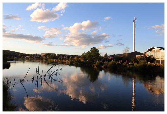
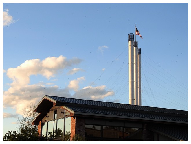
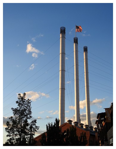
Next we headed back through the town of Sisters, on the other street! And south to Bend. A large town of more than 80,000 people that started with the two most productive sawmills in the US. Now it’s a trendy sort of place that merits REI, Victoria Secret, GAP, etc. We walked from the hotel into the Old Mill District for a nice dinner at Anthony’s. The short season supply of Copper River Sockeye Salmon was on the menu and was delicious.
JUNE 29, 2019 – Bend, OR
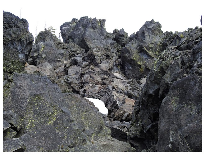
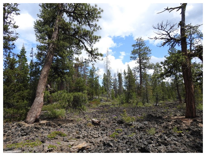
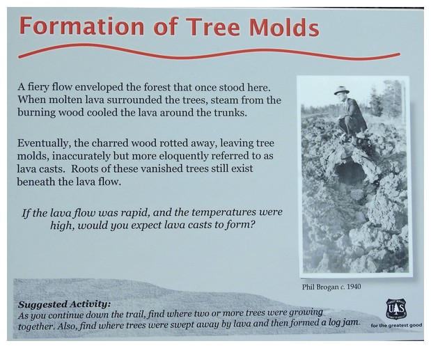
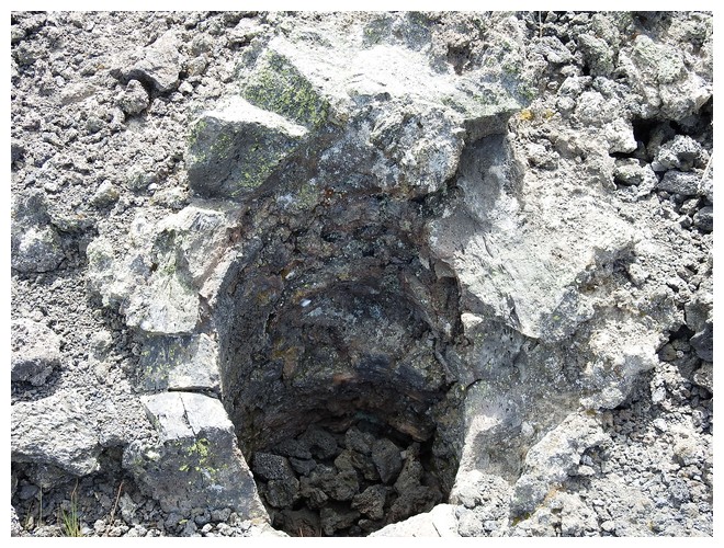
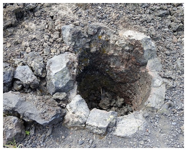
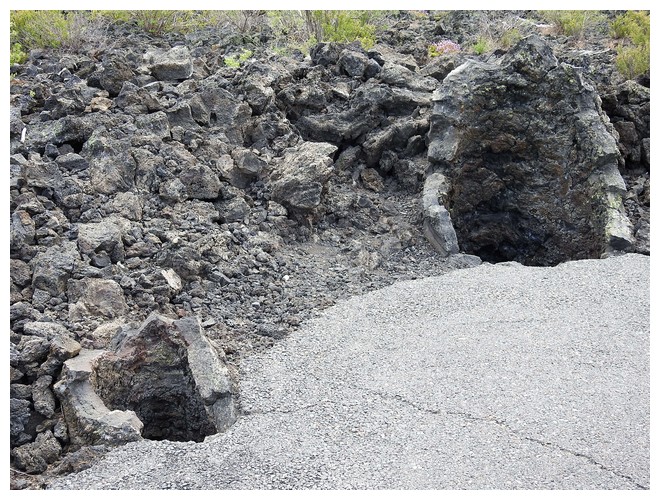
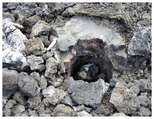
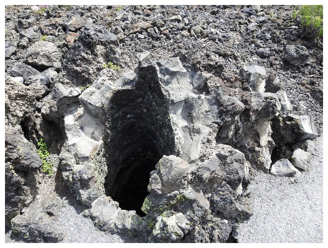
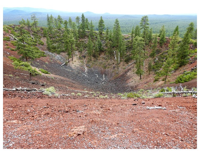
There are several stops to visit today, starting with a walk on a 1 mile loop trail in the Lava Cast Forest. This is where a lava flow came through a forest and some of the trees let off steam that cooled the lava and the mold, or cast, was created. The tree ultimately decomposed leaving behind a mold that looked like a nearly perfectly round cylinder extending 3-6 or more feet into the lava flow. Really cool
The only thing about getting to this place is that Mr. Google sent us in on the wrong road….. it first was gravel but then turned to a rutted, twisty dirt road that probably was a logging road. If it weren’t for a small SUV to rumble by us as we were turning around we would have turned back and driven those 45 minutes again on the bad road. We got back in the onward direction and came upon a gravel road in about 10 minutes. Turning left took us to the day use area and the trail. Turning right was the way we should have come in!!!! We went out that way…..
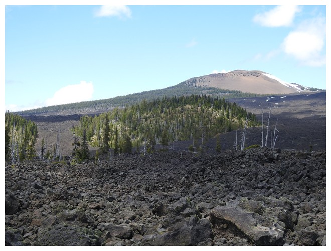
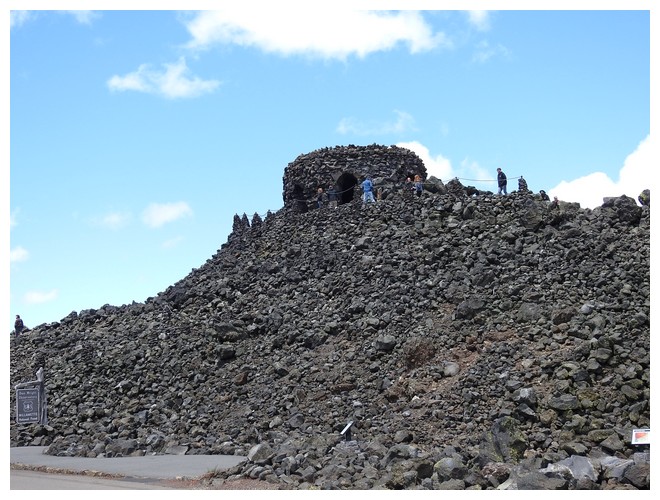
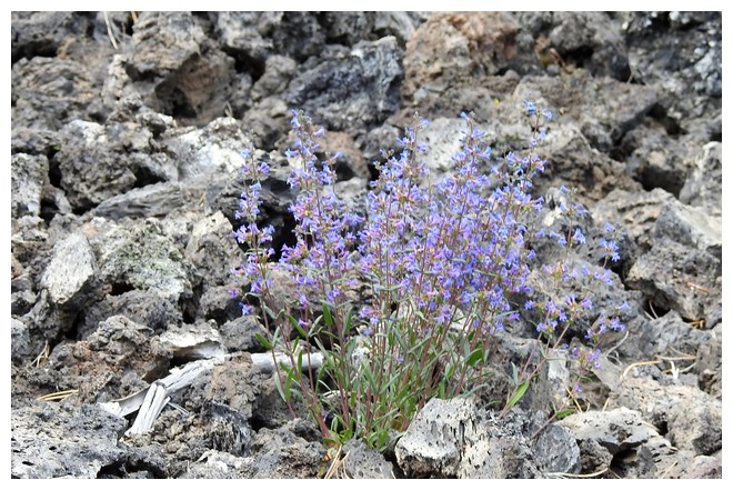
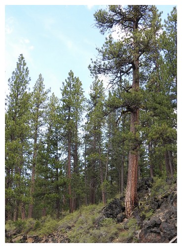
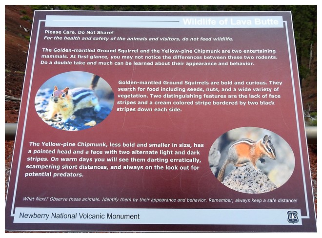
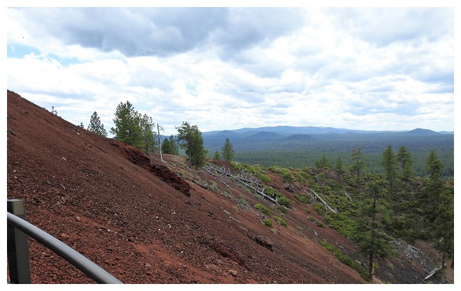
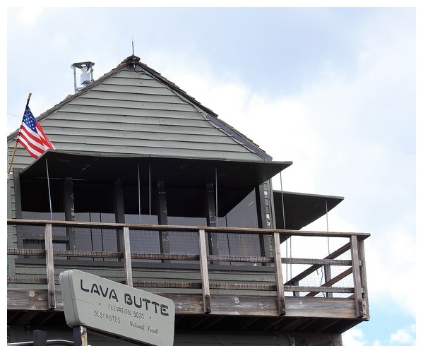
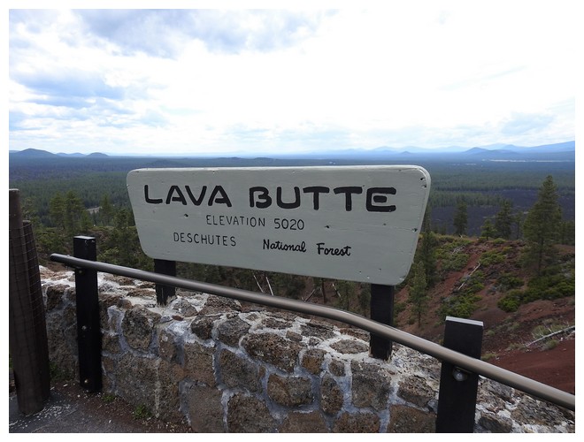
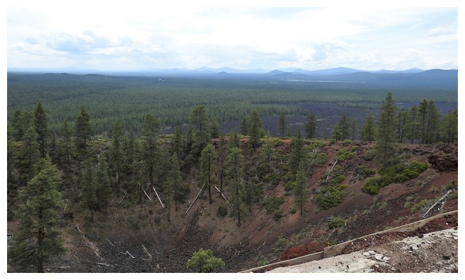
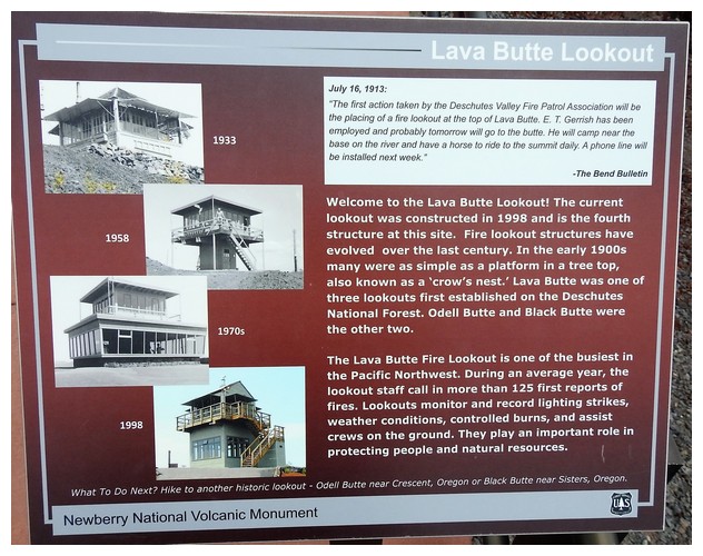
Then an easy, paved road, short drive to the Lava Butte site and visitor center. Both are amazing. We learned that you need to pay $2 in cash, no change, to take the shuttle to the top of a prominent cinder cone. What a view. In the distance to the east and south there were dozens of extinct small volcano cones or vents and its reported there are over 400 in these various lava fields. The older the field the more vegetation has made a comeback over the past several thousand years.
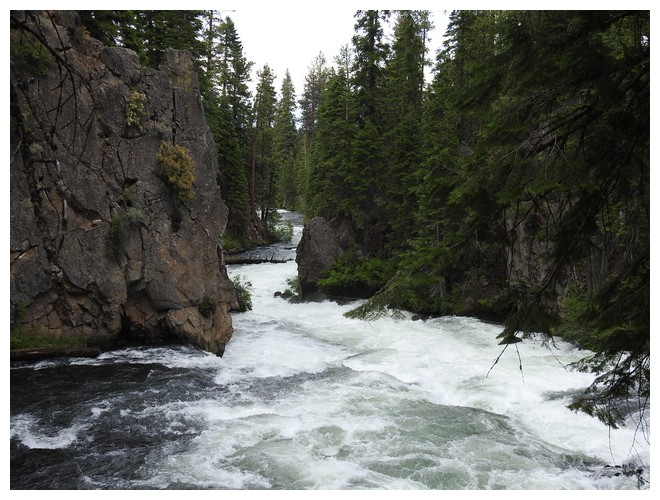
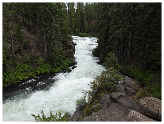
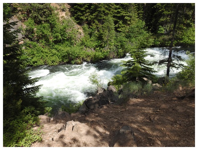
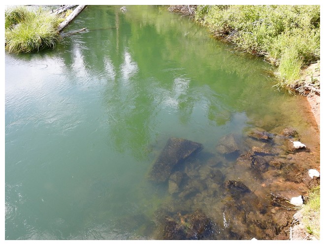
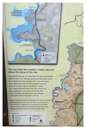
The next and final stop for the day was a 4 mile drive from Lava Butte to the Benham Falls East Trailhead. After a brief walk and then over a bridge that crosses the northern Deschutes River, we walked a level trail to the start of a major cascade in the Deschutes. It’s probably ½ mile long or so, of steep and violent rapids. The story is the adjacent lava flow clearly visible on the east side of the river, initially flowed and dammed up the river. After a long time the River found its way around the lava flow and gnawed away at the terrain creating the cascades to the Lower Deschutes where it flows by Bend a few miles to the north. Beautiful site!!!


JUNE 30, 2019 – Cascade Lakes Scenic Byway, OR
Today is the day we get on the Cascade Lake Scenic Byway, a road that circles along the many campsites of the US Forest Service as well as a couple of “simple” resorts. There is no cell service here though the lodge at some places may offer wifi, though not sure. GPS is often dodgy.
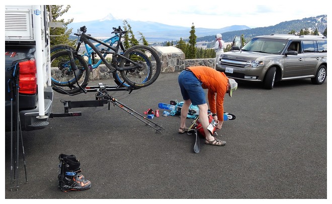
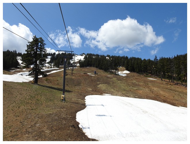
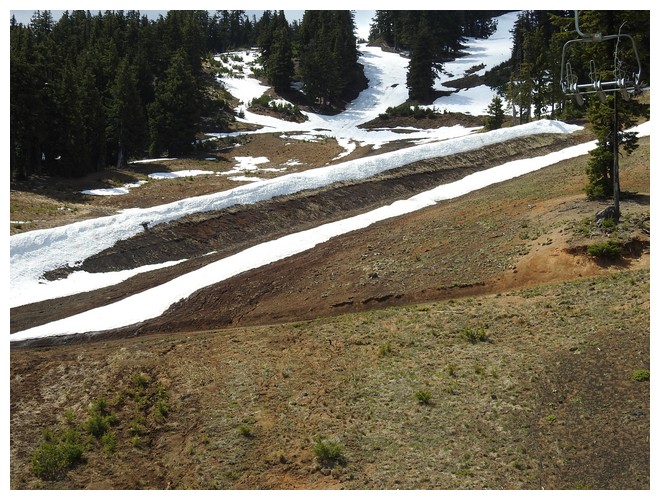
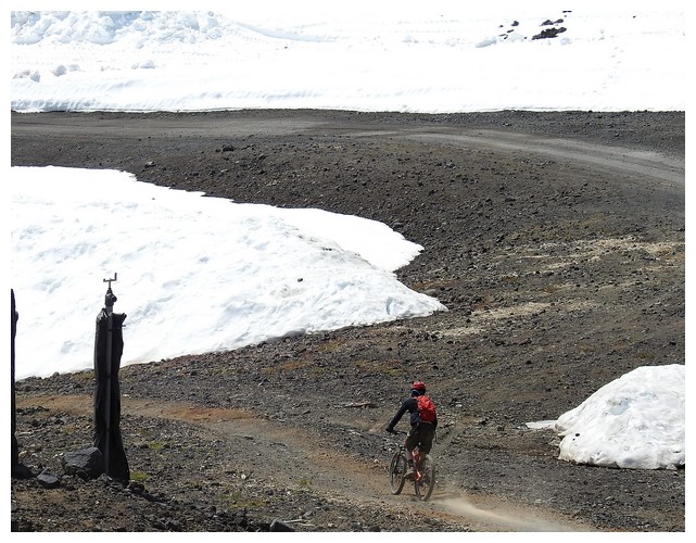
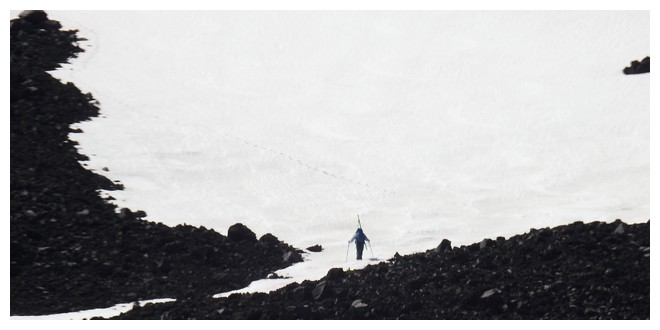
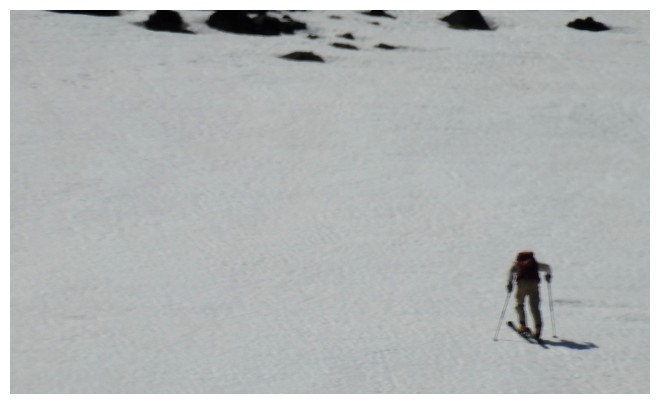
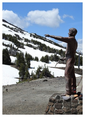
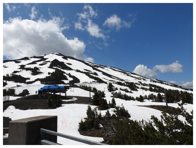
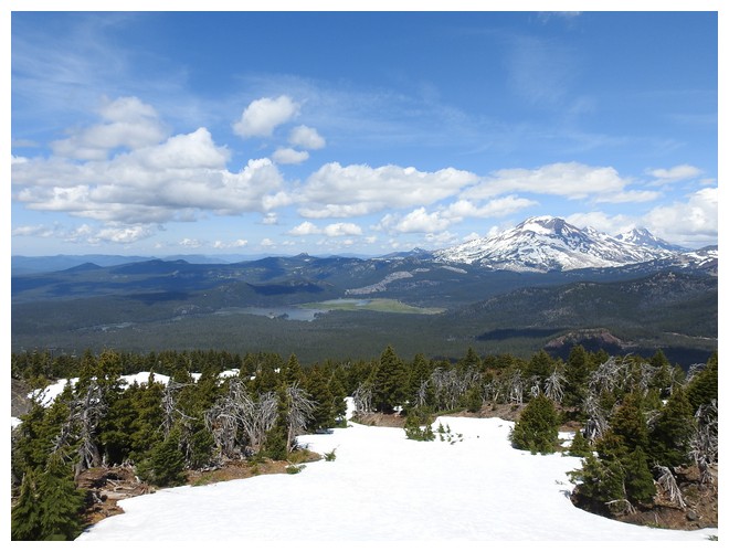
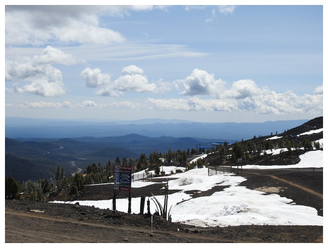
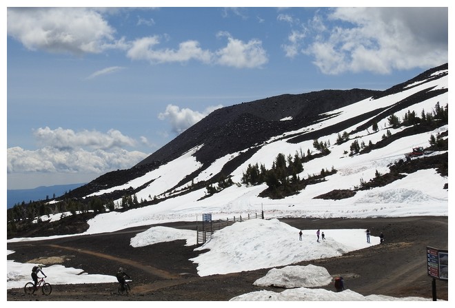
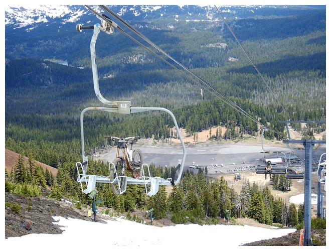
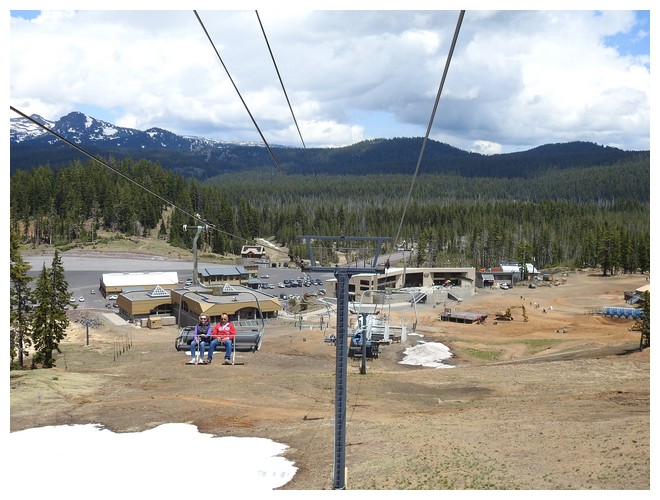
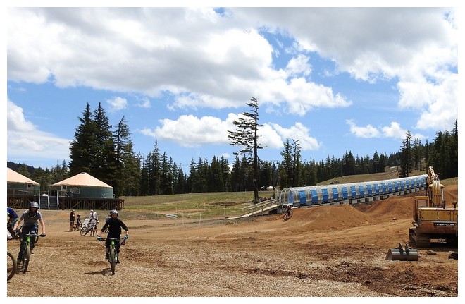
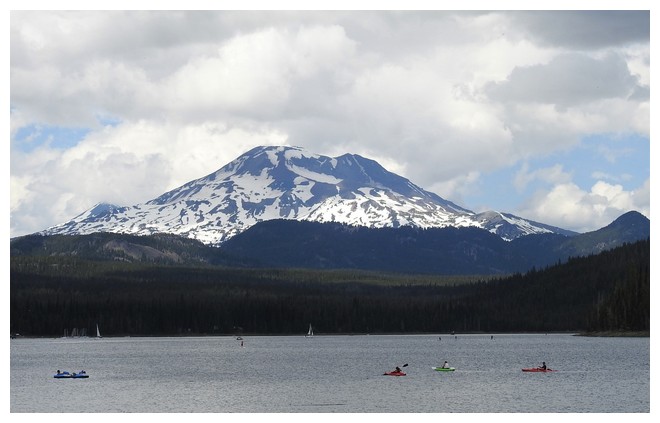
There are also many trailheads into the 200,000 acres of Three Sisters Wilderness Area. Vistas of the sisters and the other mountains of the New Cascades are frequent. Our first stop is to the chair lift at Mt Bachelor. It too is one of the large volcanically formed mountains where cone shaped vents are visible on the hillside.
We took the lift up and marveled at the views. Also at the mountain bicyclists who ride up, with their bike in the chair in front in a special cradle. They are all helmeted and some are padded at the knees and elbows. They take the ramp down for the chair’s drop off point and quickly zoom away down the ski slopes designated for them. I imagine they go up and down all day!! It’s probably exhausting. I wonder if they ski here in the winter where the lift tickets start at $80.
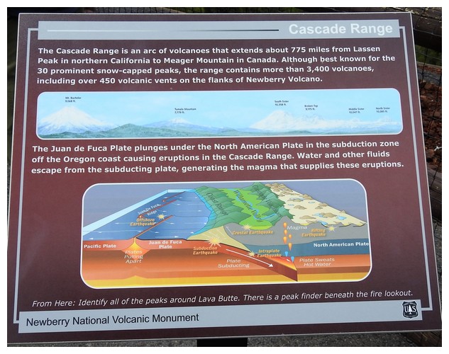
We joined a talk by the US Forest Service volunteer and learned a great deal about the area. He spoke of the formation of the mountains we could see. The old cascades to the west are much older by many thousands of years. He spoke of the Sisters and Mt Bachelor and the nearby Broken Top mountain that are relatively new. He pointed out the features on Mt B: the vent cones as well as where a glacier at one point had carved out a cirque up above us and then stopped part way down the mountain and left a prominent “glacial end moraine” of unsorted glacial till. A phrase heard a number of times on the East Coast relative to Cape Cod and the Islands.
Another very interesting conversation was about the plate tectonics we’ve heard mention of. Our volunteer had a good sized National Geographic map of the world showing the plate lines, the faults, and the volcanoes. The movement of the continents to their current position is somewhat responsible for the mountains. As the expansion of the mid-Atlantic zones created the split of the Americas from Africa and Europe it caused the subduction of the plates on the Pacific side. The North American plate is slowly being squeezed up while the Pacific Plate is diving down under. This has created the coastal ranges of the west coast, though not the Rocky Mountains as they formed much longer ago. The many fault lines experience these motions and occasionally earthquakes indicate some of the movement
In this area there is constant movement. Seismologists record many small earthquakes that we can’t feel, 2-3 on the Richter scale. There is the full expectation that somewhere in these new cascades there will be an eruption at some point. The magma is still down there! Several years ago there was a bulge being recorded in the Sisters/Mt B area by GPS. The whole area started to lift a couple of centimeters over the course of a few years. It then stopped. But were it to start up again it might indicate magma flows toward the surface.
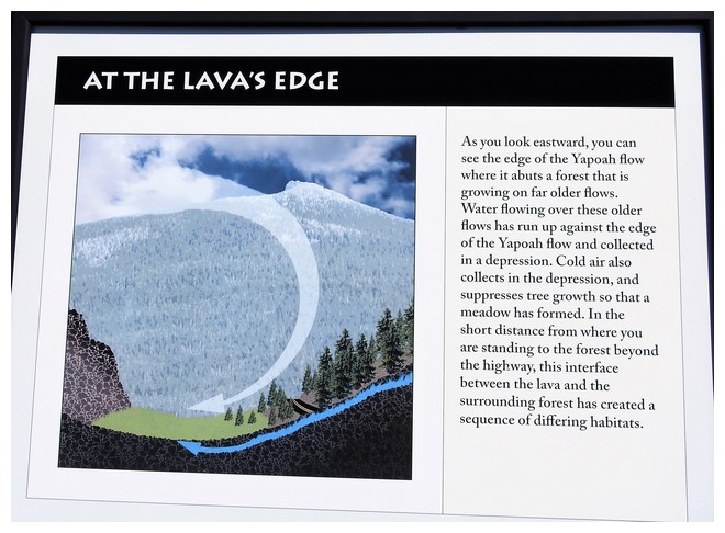
When the magma breaks through and the lava starts flowing around, it builds up the cones and resulting mountains. Sometimes it’s just a lava flow that goes in most directions for many miles. Additional flows start again on top of the old flows and the mountains build. Sometimes there is cinder and ash as we saw at lava butte where, due to the prevailing winds at the time deposited more of the cone on the northwest side. The lava broke through the thinner ash and cinder side to the northeast so the bulk of the lava field is in that direction.
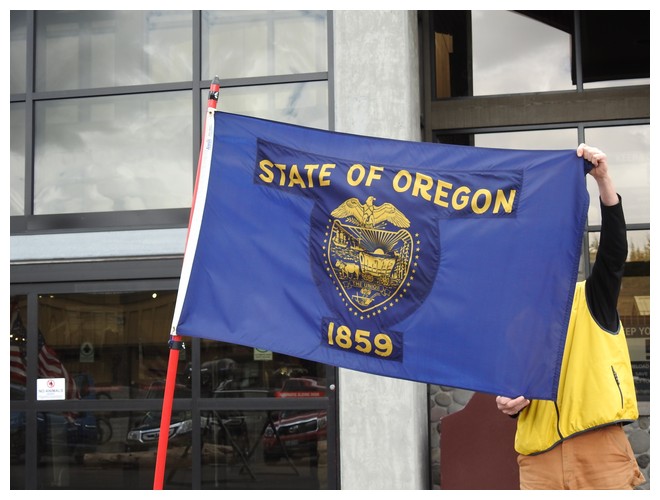
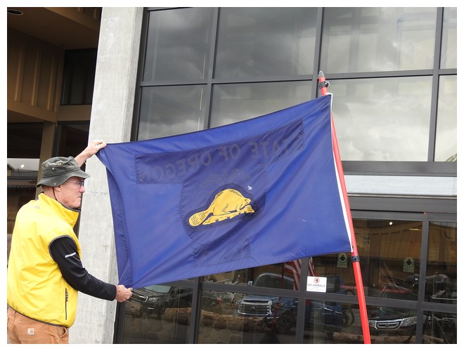
It was a fascination talk with the beautiful backdrop of Mt B and the Sisters, on a sunny nearly full blue sky day. As we headed to the parking lot we saw the Oregon state flag. It’s the only 2 sided flag in the nation.
After Mt B we tried to find an area known as Devils Garden. The information brochure we have is 10-20 years old and, according to a young FS volunteer, it may have disappeared. It was to be an area of springs under the Devils Hill lava flow that formed a stream that became silted in and turned into a meadow. It may now be a more firmly established area of trees and forest. The brochure indicated, however, that lava rocks from the Devils Hill Flow were collected and taken by James Irwin to the moon on one of the Apollo missions. Astronauts trained in the lava fields of central Oregon in 1964 and 1966 for the Apollo missions.
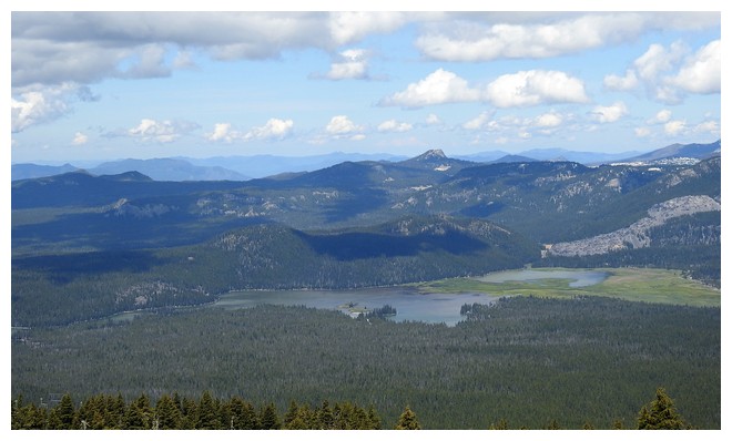
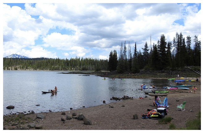
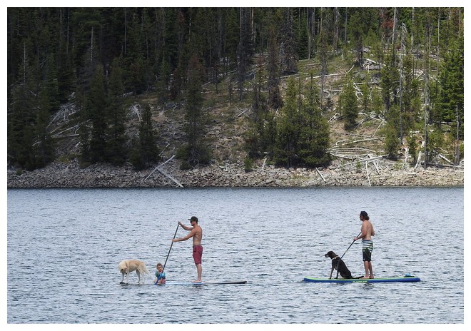
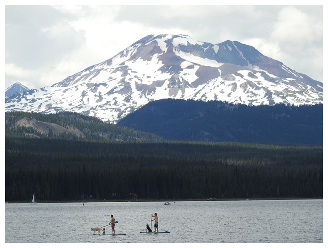
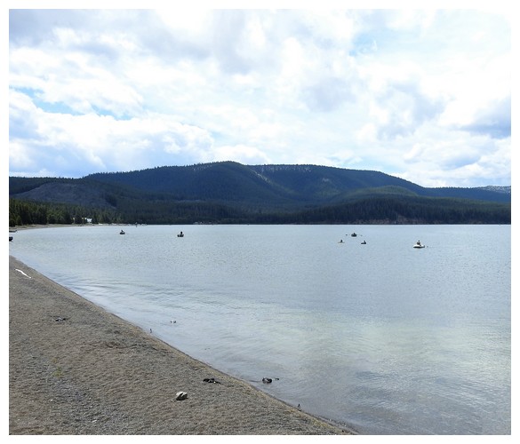
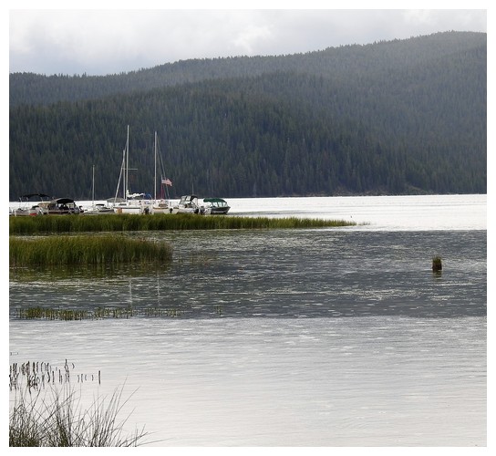
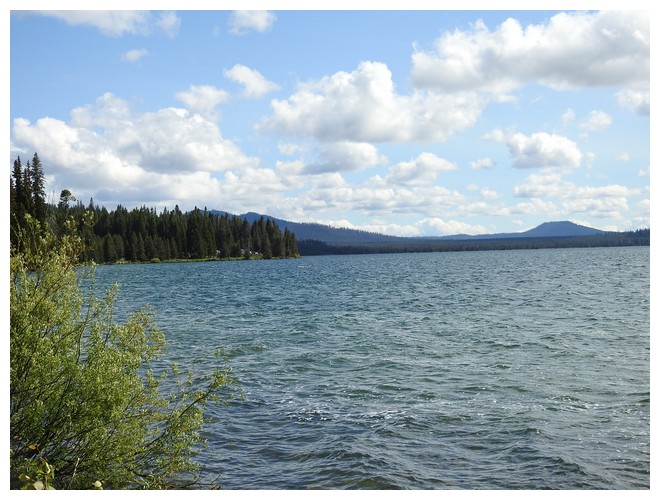
We next drove to get a view of Elk Lake. This is a large lake with boat access – sailboats and motorboats. We found a very populated beach area with kids swimming, and lots of kayaks and stand up paddle boards. We also saw pets and kids with adults on the SUPs!!!
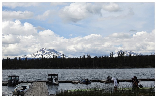
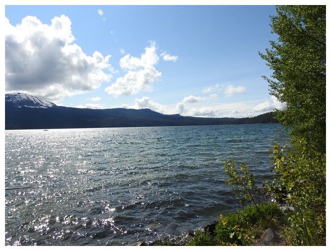
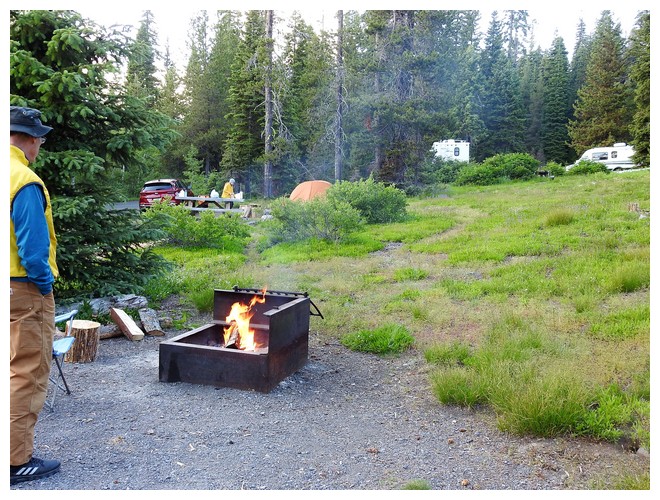
The next lake, Lava Lake, is where our campground is. We drove in, found our spot, and walked around. It’s pretty and quiet. We are near the boat launch area which is also fun to visit and watch. We put together a small campfire from salvaged wood from other firepits. It was even warm enough to have our first dinner outside, by the fire. We are in a place with no hookups and at night, with no indicator lights on in the coach, it was pitch black through the night. It cooled down nicely overnight for a good night’s sleep.


JULY 1, 2019 – Cascade Lakes Scenic Byway, OR
As we were having breakfast our site was visited by a fairly young looking deer. With a black tipped tail and large ears, I think this is a Mule deer. It wandered through munching on the long grass.
After breakfast and unmooring we drove farther along the Cascade Lake Scenic Byway through sections that were thoroughly forested with occasional signs for a trail head or a campground. These would be the FS campgrounds some requiring reservations but many not and are often limited to pit toilets and an occasional water tap for filling containers, not RVs.
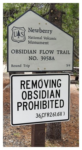
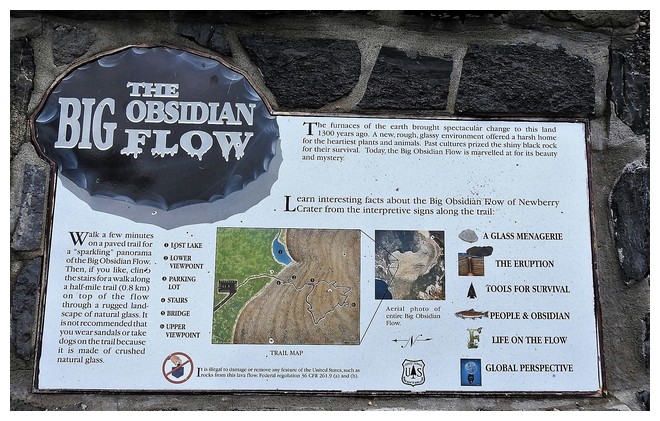
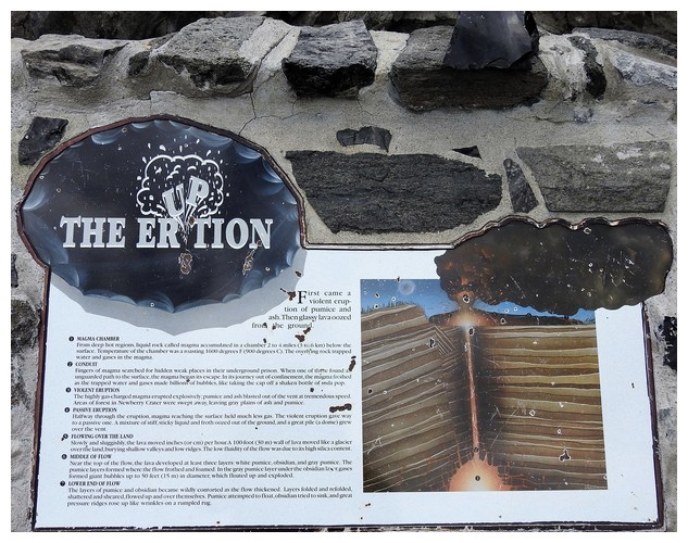
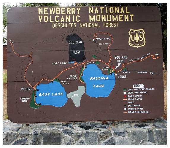
We turned left to head back to the north-south Rt 97 and go to the Newberry Caldera and see the two lakes there. Newberry Volcano is the largest ice-age volcano in Oregon, encompassing 500 square miles. Many of the vents we see, including Lava Butte that we visited 2 days ago, are in this zone. The area was designated as the Newberry National Volcanic Monument in 1990.
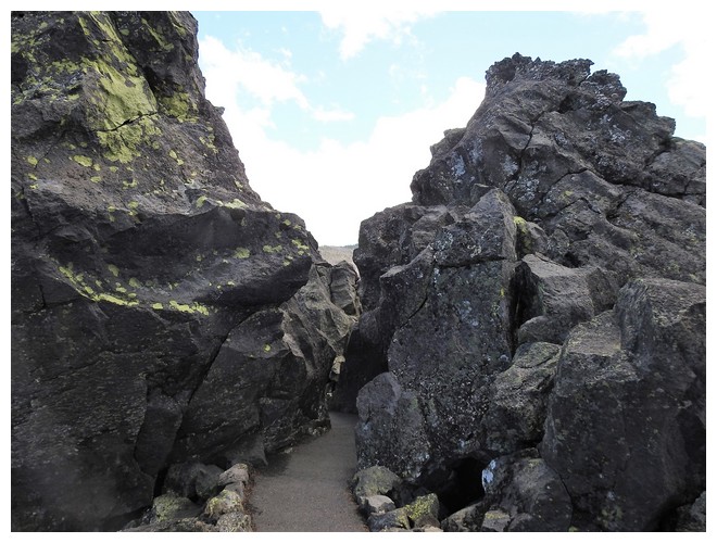
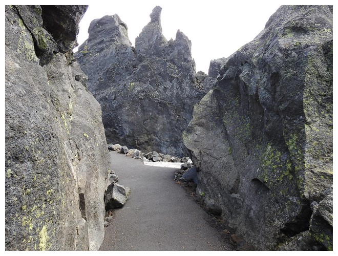
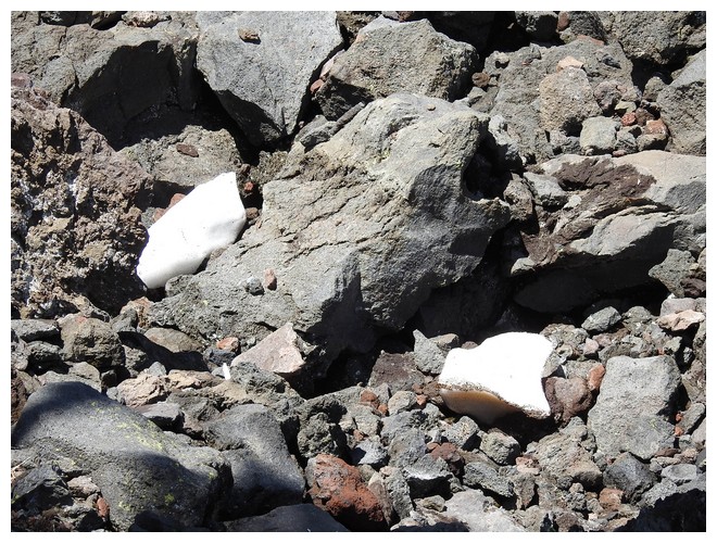
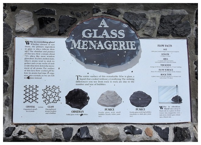
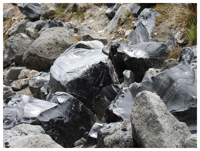
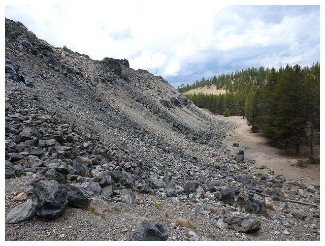
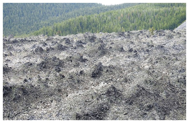
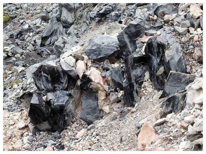
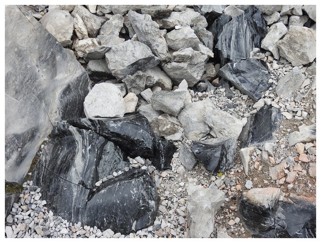
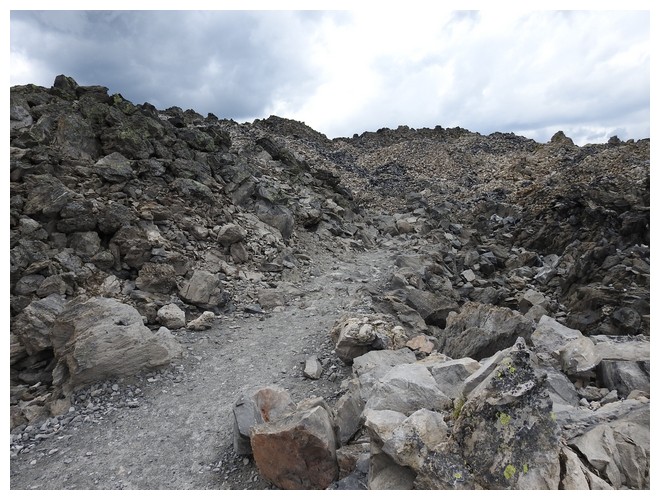
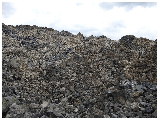
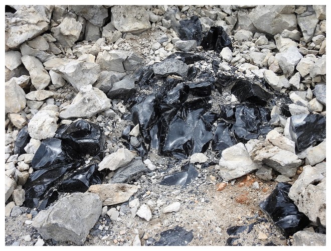
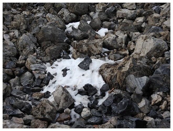
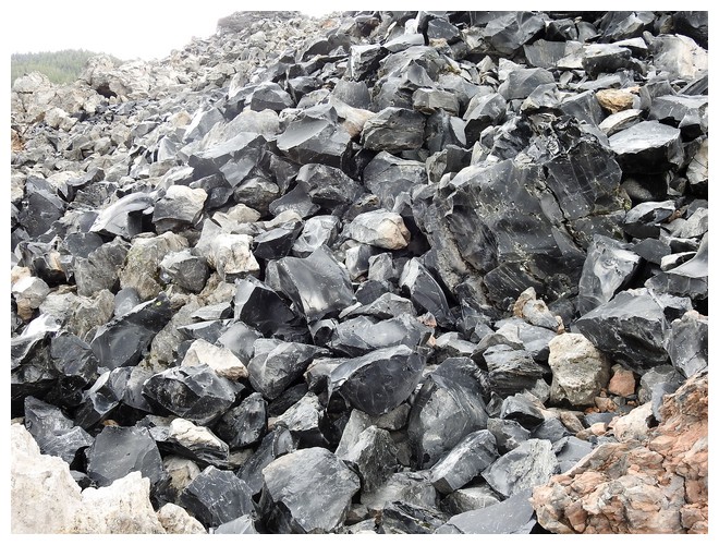
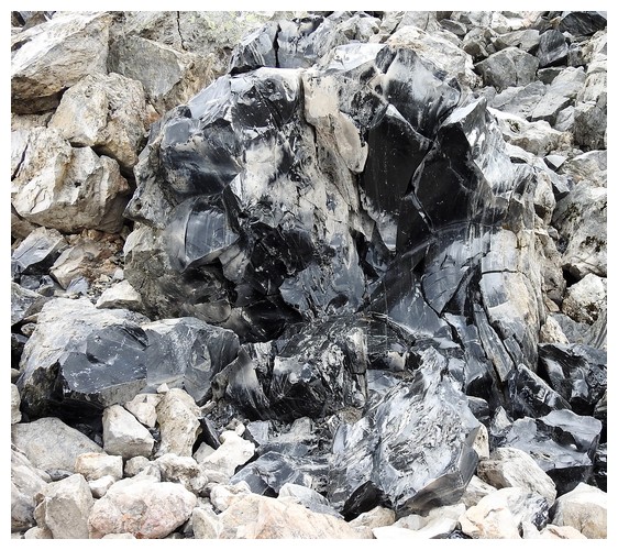
There were several enormous violent eruptions that formed the five mile wide caldera. Within this enormous crater, very high above the roads within, are two lakes and a fascinating lava flow comprising of a large amount of obsidian. The formation has something to do with the lava coming to the surface so fast that air bubbles don’t form the way they do in the various types of pumice. The molten material is very high in silica so it resembles glass. It fractures very easily and can have very sharp edges. The people living here thousands of years ago used it when making arrow heads and scraping tools. It’s very tough when not under a heavy impact. I cracked a piece by smashing it with another non obsidian rock.
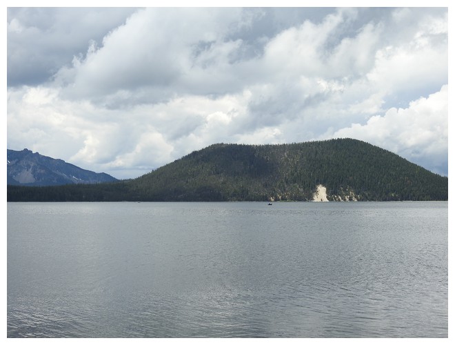
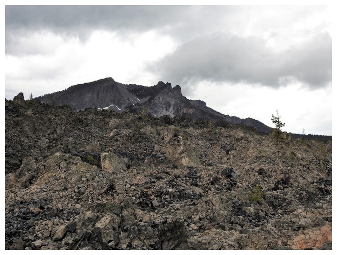
Mt Paulina reigns above the formations made with some obvious signs of blow outs during the eruptions. The obsidian lava flow is clearly linked to the mountain and is a lumpy, rocky mass approximately 150-200’ thick and a mile wide. I went to the top, traversing rocks outcrops, a rocky trail, and beautiful veins, some quite large, of the black obsidian. We visited the edge of both lakes to learn there is really good fishing due to salmon and trout being stocked within. Turns out there are warnings for fishing in the East Lake to not eat the fish due to the high mercury content in the fish due to its presence in the water. East Lake is spring fed and the source is below somewhere in the lava/caldera formation.
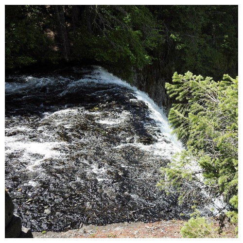
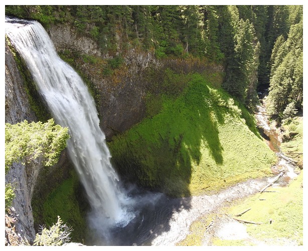
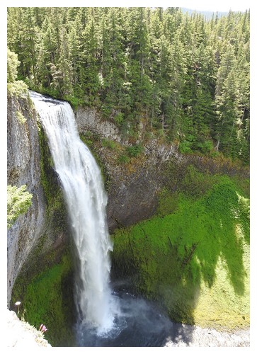
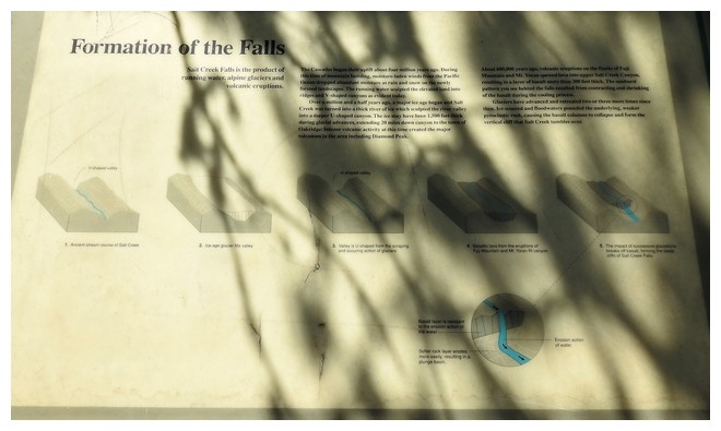
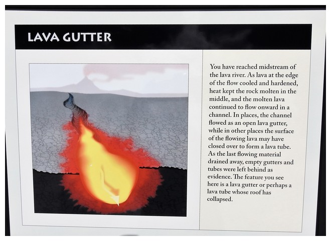
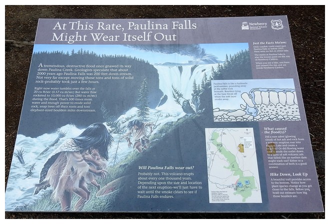
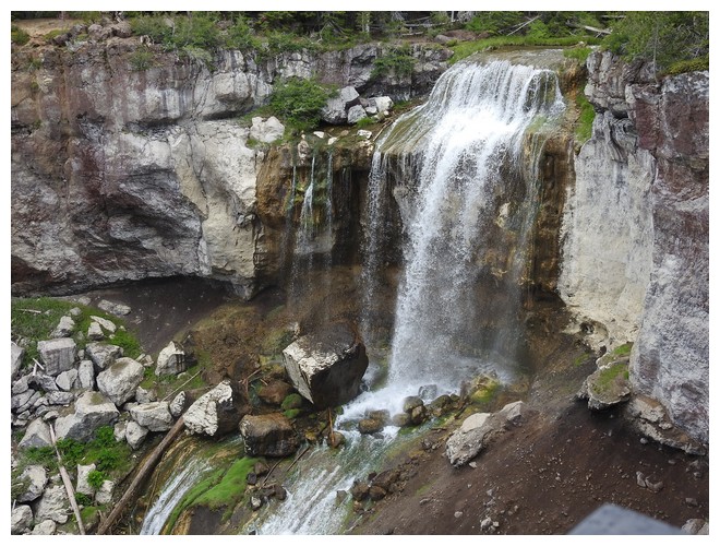
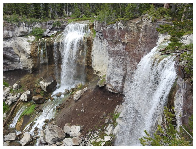
There was a great simple graphic showing how the magma, well below the surface, starts to escape through weaknesses and fissures in the overlying rock. It mounds up under great pressure until it explodes out the top of the mound. At Newberry this mound was five miles wide and no one knows how high when the magma chamber was emptied enough to cause the overlying materials to collapse downward creating the caldera. The lakes are at approximate elevation 6,300 feet, the crater rim looms high above, and we drove down this created mountain and dropped to elevation 4,200 feet. On the way down is the Paulina Falls. Actually it’s a double falls that is where there was a weakness in the lava formations of the crater rim and the lake spills out. It was really cool to stand at the top of the one of the sections of the falls and see it spill over. I haven’t done that before.
At the end of our drive for the day we went to a store for some provisions as we are boon docking again tomorrow night. We’re not sure if there will be markets along the way to Diamond Lake Campground that is our last stop before going to Crater Lake on Wednesday. We can know last until we leave Crater Lake and start our return journey to Portland with a 2 night stop near Oakridge OR.
We pulled in, a long drive in, to the La Pine State Park and Campground. Very nice facility!!!! It has full hookups for the RV and nice bath/shower facilities as well.A
JULY 2, 2019 – Diamond Lake CG, near Crater Lake, OR
As it’s a short drive today AND it’s the semi-finals for the women’s FIFI world cup!!! We had a light breakfast and headed back to Rt 97 and then south. We found slim pickings for truck provisions, but found cheap propane ($2.29), fill at the pump DEF (3.39) and then struggled to find non biodiesel fuel. We finally found B5 which is 5% biofuel and is OK for this engine.
At the station we asked where to find a sports bar as it was now close to noon and the match was starting. We were directed to Loree’s Chalet Restaurant and Motel. We learned that Deb would turn on the TV in the bar for us and we said we’d like some lunch. Seems the service provider only had the match on in Spanish. Oh well – it’s easy enough to see what’s going on!!! Good outcome for the women and now onto the 2019 finals!!! Yeah……
We continued south until the right turn towards Crater Lake. The campground for the night is at Diamond Lake Campground. We switched spots to one across the road from the lakefront and it turned out to be a beautiful evening with lots of stars. Camping neighbors are very spread out and many had fires glowing as the light faded around 10pm. I stayed out a bit to see the stars but it was getting cold. I turned on my star gazing apps and learned the very bright light to the south is Jupiter. That’s cool!
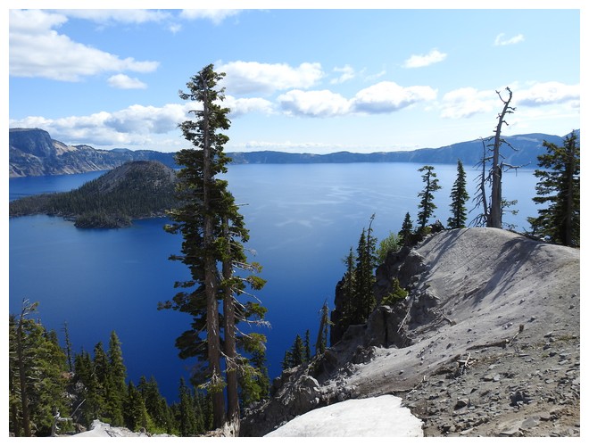
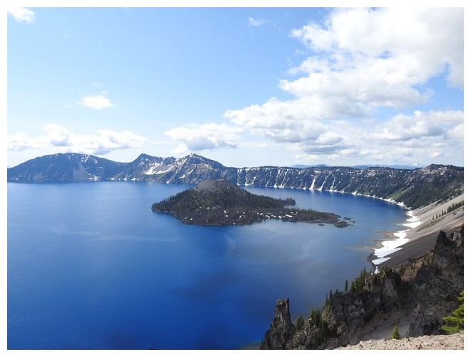
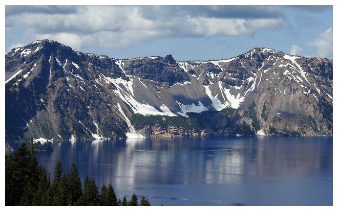
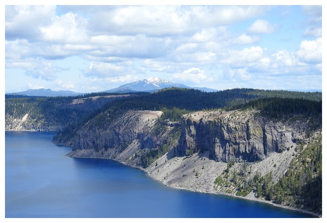
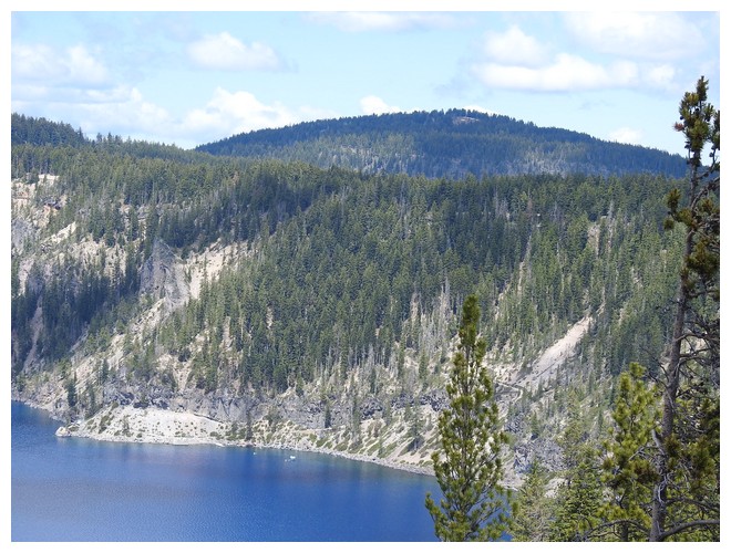
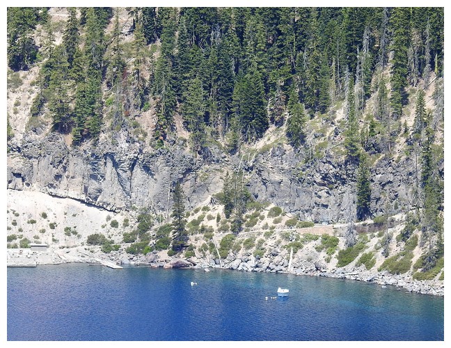
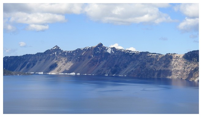
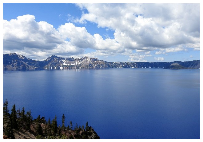
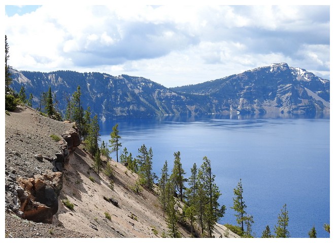
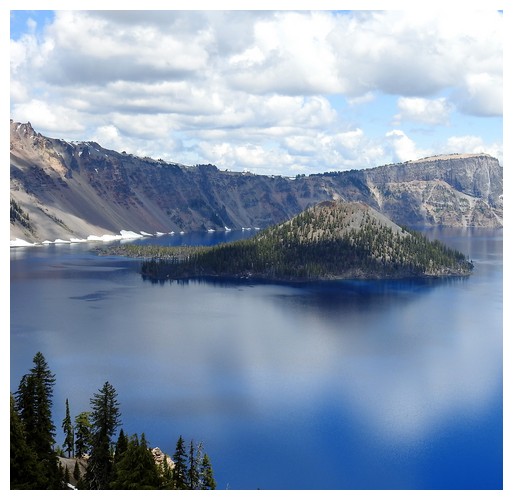
Tomorrow, finally, another bucket list item!!! Crater Lake and the rim road are open…!